

Background
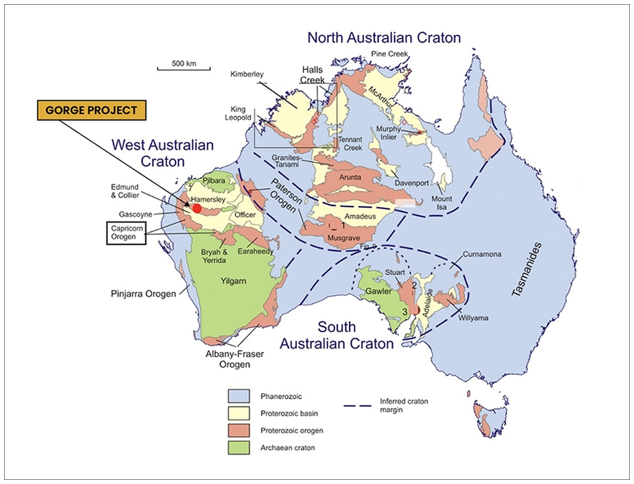
Exploration Licence 08/3737 Gorge is located approximately 110km west of the town of Paraburdoo in Western Australia. Gorge covers an area of 81 square kilometres of Proterozoic age metasediments of the Capricorn Orogen and is prospective for several styles of mineralisation.
Historical records show sporadic exploration was carried out across the Gorge licence in the mid to late 1980s and late 2000s. This work identified several areas with rock chip results peaking at 134 g/t gold, with mineralisation observed over approximately 5 km of strike.
Work In the late 1800s small scale miners were active across the licence area collecting alluvial and elluvial gold from within and adjacent to dry stream beds. During this time bedrock sources of primary gold mineralisation were discovered where shallow shafts were established and relatively high-grade gold ore was extracted.


Newspaper articles published in 1896 and 1897 report bedrock mineralisation at Gorge West extending for more than 1km in length with extracted ore returning 14oz gold per ton (+450g/t gold). At Gorge East (104 Prospect) bedrock mineralisation extended for approximately 200m and extracted ore reported assays of 160oz gold per ton (+5,000g/t gold).
More modern exploration for precious metals commenced in the 1980s. Australian Anglo American Limited (AAL) evaluated the Gorge East area (104 Prospect) during 1985 with work including drainage sampling, rock chip sampling and soil sampling. Drainage sample results peaked at 192ppb gold, soils up to 233,300ppb gold (233g/t gold), and rock chip samples up to 62g/t gold. Limited drilling of seven RAB holes and seven diamond holes was completed which included documented results of 1m at 35g/t gold from 1m (RABP005), and 1m at 4.7g/t gold from 26m (DD006) however accurate locations for these holes were not able to be determined from the historical documentation so these hole locations are not currently available in the database but will be confirmed on the ground in the coming months.

Following the positive results of Australian Anglo American Ltd at the Gorge East Prospect, and noting the gold potential of the broader geology, Metana Minerals NL (Metana) embarked on a regional heliborne drainage sampling programme along 100km of strike covering approximately 2,000 square kilometres of the Capricorn Orogen from Gorge in the west to south of Paraburdoo in the east. Work was carried out during the mid to late 1980s. This was successful in generating more than 10 areas with elevated gold in streams across 100km of geological strike, including an area of around 5km x 2km within the current Gorge exploration licence.
During the heliborne work historical alluvial and elluvial surface workings, and bedrock workings from the late 1800s were noted and mapped. More than 6 areas of surface workings across 5km of strike were noted and results of drainage sampling across the licence included 163ppb gold, 138ppb gold, 137ppb gold, 106 ppb gold, 90ppb gold, and 82ppb gold with many other results greater than 10ppb gold.
During the 1990s small scale surface mining was carried out on alluvial and elluvial areas within the Gorge licence. No reliable production records are available from this period, however machinery and other infrastructure remining on site suggests reasonable gold was being sourced, and satellite imagery shows several areas subject to machine working of surface material.
Between 2006 and 2010 Ashburton Resources Limited (Ashburton Resources) carried out reconnaissance rock chip sampling across several areas within the current Gorge project area, primarily concentrating on the Gorge West prospect. Rock chip sample results included 134g/t gold, 11.7g/t gold and 6.1g/t gold. No further work was carried out by Ashburton Resources. These rock chip results, strike length of historic workings and footprint of elevated gold in drainage samples over an area of more than 2 square kilometres provide a compelling early-stage gold exploration target of significant size.

Recent Work
During the early 2020s small scale reconnaissance prospecting activities were completed across the Gorge licence. Several gold nuggets were collected ranging in size from <2g per piece to more than 100g. These were collected from alluvial areas within the Gorge West prospect. The proximity of the nuggets suggests that a primary bedrock gold source may be nearby.


Key Highlights
- Acquisition of 100% interest in the Gorge Project (E08/3737), Western Australia.
- Historic exploration at Gorge identified gold mineralisation with rock chip samples up to 134g/t Au and soil samples up to 233g/t Au.
- Licence located 110km west of Paraburdoo, covering 81 km² of Proterozoic metasediments in the Capricorn Orogen, with gold mineralisation identified over approximately 5km of strike.
- E08/3737 is granted and has executed Native Title Agreement in place.
- Consideration: A$100,000 cash and A$400,000 equivalent in GEO shares, issued at £0.004 per share, equating to 48,130,000 new ordinary shares.
- The £0.004 issue price represents a 25% premium to GEO’s £0.0032 closing price on 16 October 2025. All consideration shares subject to a 12 month holding lock.
- Surface Rights Deed: vendor retains near-surface gold rights to 2 metres (extendable to 4 metres with consent); capped at 10,000 tonnes excavation; GEO holds exclusive rights at depth and an option to purchase surface rights outright.
- Work programme on Gorge Project is scheduled to commence during current quarter.
Current Status
During the current quarter planning for a high resolution airborne magnetic and radiometric survey is being finalised with quotations being received. It is expected this survey will be completed during the first quarter of 2026. This data will allow large scale geological structures to be identified and integrated with existing geochemical data.
Detailed airborne lidar quotations are being sought and it is expected this survey will be complete during the first quarter of 2026. Lidar is particularly helpful for logistics and planning utilising the detailed imagery and accurate spatial definition.
Further work to be undertaken includes access rehabilitation and grid based geochemical sampling. These activities are scheduled for Q1 and Q2 2026 along with Heritage surveys in advance of drilling. Following review of results achieved during Q2 2026 initial drilling is scheduled for Q3 2026 which is likely to be Rotary Air Blast (RAB) or Reverse Circulation (RC).