

Background
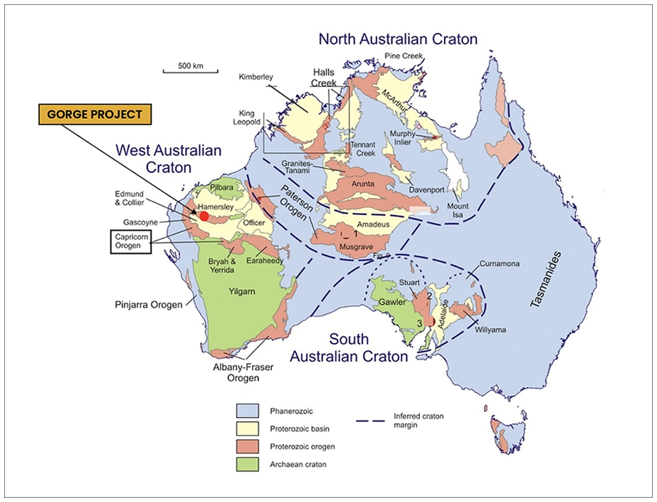
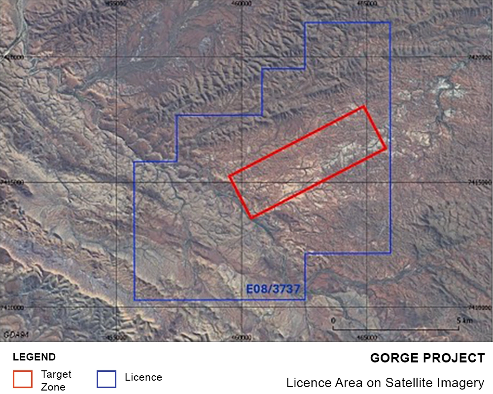
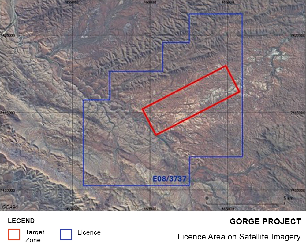
Exploration Licence 08/3737 Gorge is located approximately 110 km west of the town of Paraburdoo in Western Australia. Gorge covers an area of 81 km² of Proterozoic age metasediments of the Capricorn Orogen and is prospective for several styles of mineralisation.
Historical records show sporadic exploration was carried out across the Gorge licence in the mid to late 1980s and late 2000s. This work identified several areas with rock chip results peaking at 134 g/t gold, with mineralisation observed over approximately 5 km of strike.
In the late 1800s, small-scale miners were active across the licence area collecting alluvial and elluvial gold from within and adjacent to dry stream beds. During this time bedrock sources of primary gold mineralisation were discovered where shallow shafts were established and relatively high-grade gold ore was extracted.
Newspaper articles published in 1896 and 1897 report bedrock mineralisation at Gorge West extending for more than 1 km in length with extracted ore returning 14 oz gold per ton (+450 g/t gold). At Gorge East (104 Prospect) bedrock mineralisation extended for approximately 200m and extracted ore reported assays of 160 oz gold per ton (+5,000 g/t gold).
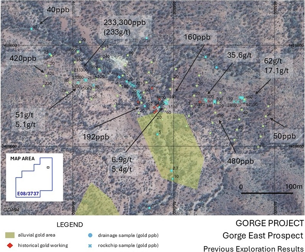
More modern exploration for precious metals commenced in the 1980s. Australian Anglo American Limited (AAL) evaluated the Gorge East area (104 Prospect) during 1985 with work including drainage sampling, rock chip sampling and soil sampling. Drainage sample results peaked at 192 ppb gold, soils up to 233,300 ppb gold (233 g/t gold), and rock chip samples up to 62 g/t gold. Limited drilling of seven RAB holes and seven diamond holes was completed which included documented results of 1m at 35 g/t gold from 1m (RABP005), and 1m at 4.7 g/t gold from 26m (DD006). At the time of the historical data review, accurate locations for certain drill holes could not be confirmed from the available records. Subsequent field reconnaissance has since confirmed historic drill collar locations at the 401 Prospect.
Following the positive results of Australian Anglo American Ltd at the Gorge East Prospect, and noting the gold potential of the broader geology, Metana Minerals NL (Metana) embarked on a regional heliborne drainage sampling programme along 100 km of strike covering approximately 2,000 square kilometres of the Capricorn Orogen from Gorge in the west to south of Paraburdoo in the east. Work was carried out during the mid to late 1980s. This was successful in generating more than 10 areas with elevated gold in streams across 100km of geological strike, including an area of around 5 km x 2 km within the current Gorge exploration licence.
During the heliborne work historical alluvial and elluvial surface workings, and bedrock workings from the late 1800s were noted and mapped. More than 6 areas of surface workings across 5 km of strike were noted and results of drainage sampling across the licence included 163ppb gold, 138ppb gold, 137ppb gold, 106 ppb gold, 90ppb gold, and 82ppb gold with many other results greater than 10ppb gold.
During the 1990s small scale surface mining was carried out on alluvial and elluvial areas within the Gorge licence. No reliable production records are available from this period, however machinery and other infrastructure remaining on site suggests reasonable gold was being sourced, and satellite imagery shows several areas subject to machine working of surface material.
Between 2006 and 2010 Ashburton Resources Limited (Ashburton Resources) carried out reconnaissance rock chip sampling across several areas within the current Gorge project area, primarily concentrating on the Gorge West prospect. Rock chip sample results included 134 g/t gold, 11.7 g/t gold and 6.1 g/t gold. No further work was carried out by Ashburton Resources. These rock chip results, strike length of historic workings and footprint of elevated gold in drainage samples over an area of more than 2 square kilometres provide a compelling early-stage gold exploration target of significant size.
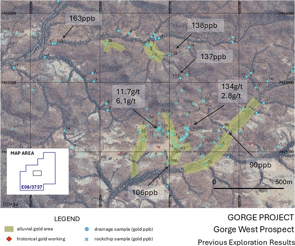
Historic Work Programme
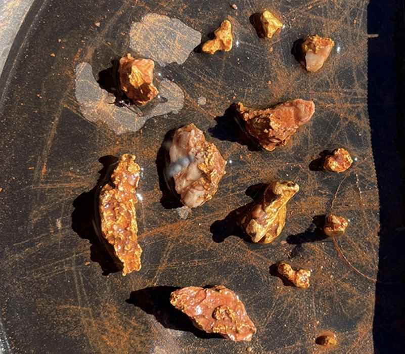
During the early 2020s small scale reconnaissance prospecting activities were completed across the Gorge licence. Several gold nuggets were collected ranging in size from <2g per piece to more than 100g. These were collected from alluvial areas within the Gorge West prospect. The proximity of the nuggets suggests that a primary bedrock gold source may be nearby.
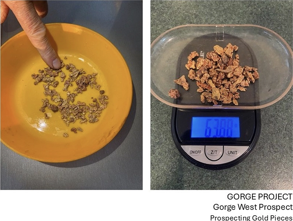
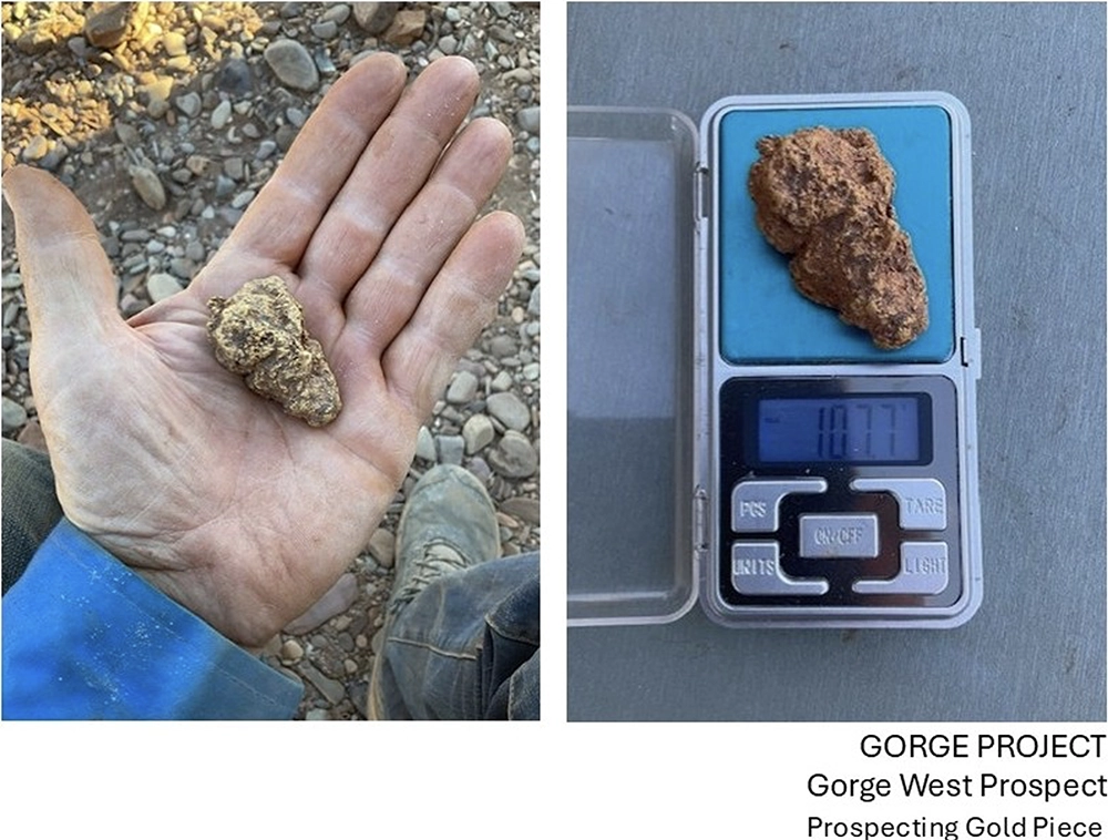
Progress To Date
Recent Work Programme
The 2026 exploration programme commenced following the announcement on 13 April 2026, which outlined a structured work programme across the Gorge Project.
Field activities commenced in May 2026 and focused on validating historical exploration data, confirming historic workings and undertaking systematic geological mapping across key target areas. This marked the transition from desktop review into active field-based exploration.
Airborne geophysical surveys were completed during this period, including LiDAR, magnetic and radiometric datasets, supported by aerial photography. These datasets have provided a high-resolution framework for structural interpretation and have materially improved understanding of the project geology.
LiDAR & Aerial Photography Survey Results
The high-resolution LiDAR and aerial photography survey over the full Gorge Project licence area was completed ahead of schedule in May 2026 by Aerometrex Ltd.
The results have materially improved GEO’s ability to identify and map key surface features across the Project, including historic workings, shafts, geological outcrops, access tracks and local topography.
Figure 1 below shows the LiDAR-derived digital terrain model across the Project area, including target areas, historical workings and the tenement outline, providing a significantly improved surface dataset for geological and logistical planning.
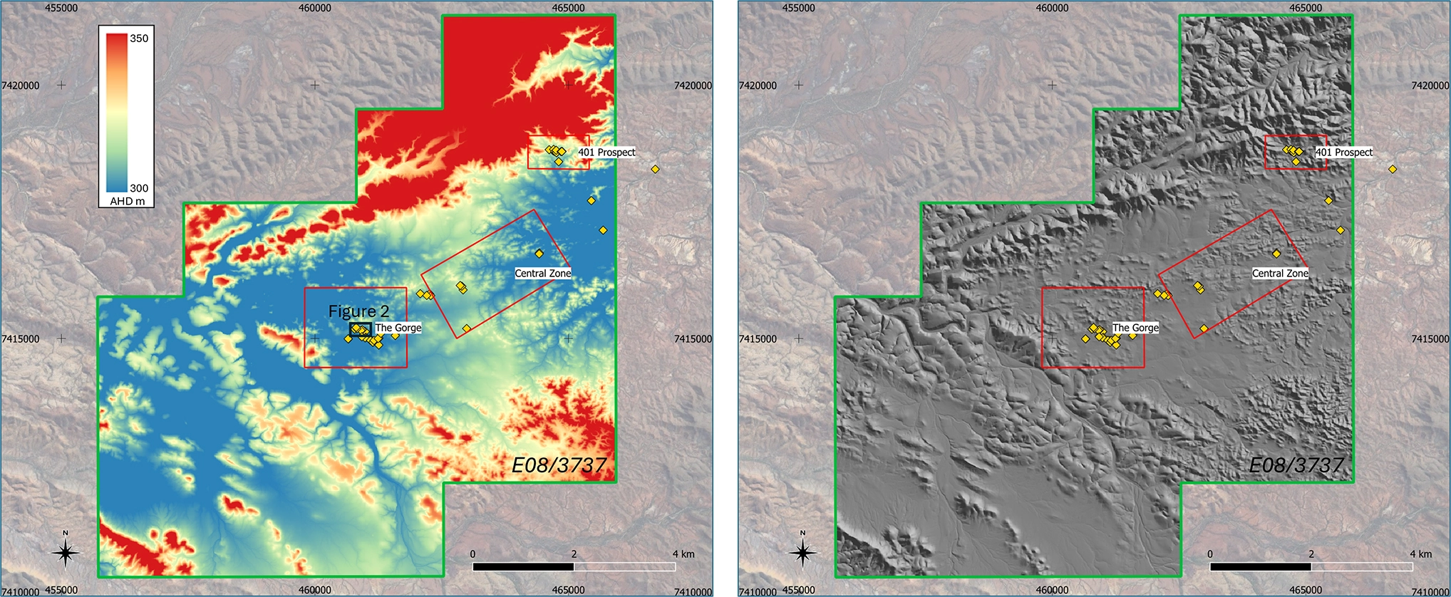
Figure 1 – LiDAR DTM results with target areas, historical workings and tenement outline. (Left) pseudo colour (Right) grey scale with sun shading. Plan view.
At the Gorge West area, the benefits of the new dataset are particularly clear. Figure 2 below shows how the aerial photography and LiDAR-derived terrain model enable clearer identification of historic shafts and workings, providing important information for follow-up mapping, access planning and future drill preparation.
This information will be integrated with the magnetic, radiometric and field datasets to assist geological interpretation, target generation and planning for the proposed maiden drilling programme.
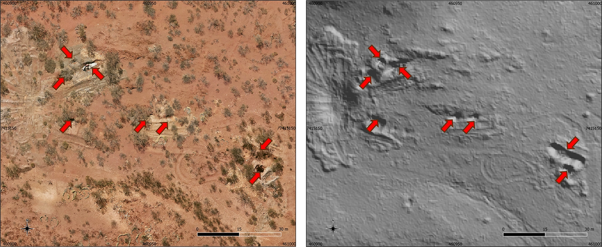
Figure 2 – Gorge West mining area, historic shafts shown by red arrows (Left) Aerial Photography (Right) DTM grey scale. Plan view.
Magnetic & Radiometric Survey Results
The airborne magnetic survey over the full Gorge Project licence area was completed in June 2026. The results are being used to enhance GEO’s understanding of the Project’s geology, structural framework, and potential controls on mineralisation.
Initial interpretation of the magnetic data has improved the definition of the previously recognised approximately 5 km trend of historical gold mineralisation and workings. This trend is now interpreted as a major northeast-trending structural zone, with areas of demagnetisation that may potentially be indicative of hydrothermal fluid flow associated with a significant gold system.
The mineralised gold trend is also interpreted to be offset by later northwest-trending structures. The intersection of these significant structures may represent important controls on gold mineralisation. Figure 3 below shows the magnetic survey results across the Project area, including the target areas, historical workings and tenement outline.
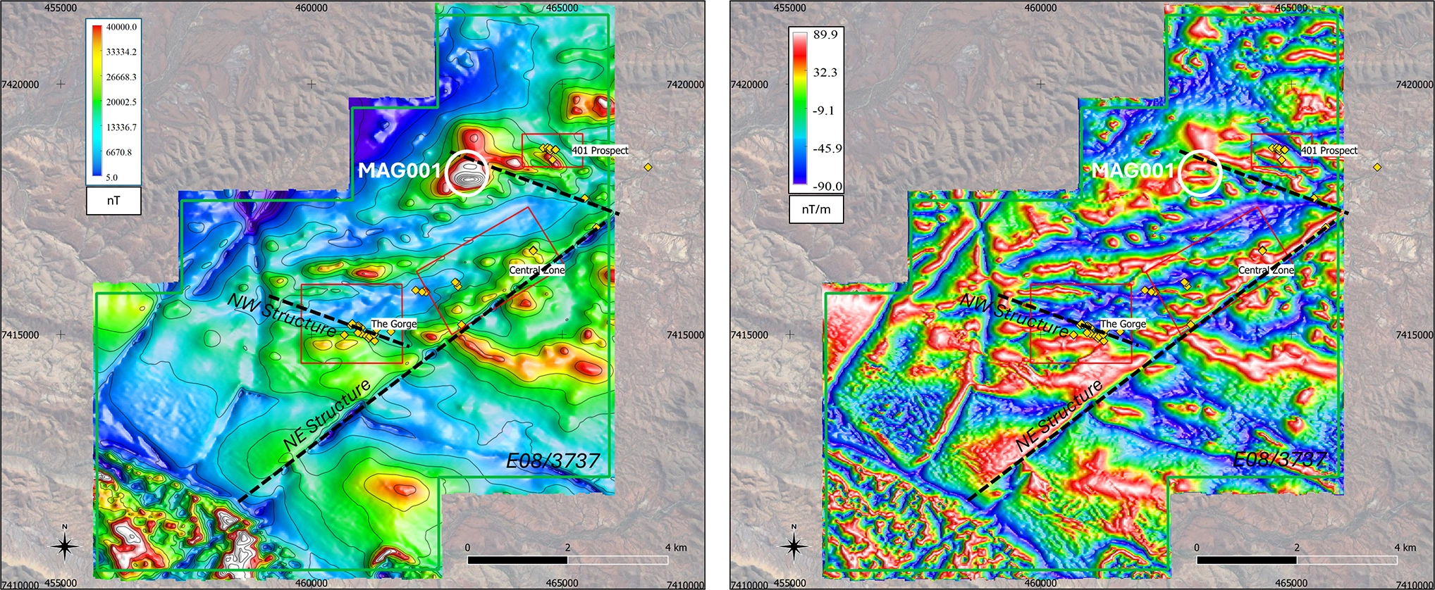
Figure 3 – Magnetic survey results with target areas, historical workings and tenement outline. (Left) RTP image (Right) Tilt Derivative image. Plan view.
Priority Magnetic & Radiometric Anomalies
The airborne survey identified a new high-priority magnetic anomaly, MAG001, in the northwest of the tenement. The anomaly is strike-limited, has an amplitude of approximately 400nT, and 3D inversion modelling indicates a depth to top of approximately 300m beneath surface with significant vertical extent.
Importantly, MAG001 is coincident with a topographic anomaly identified from the recently completed LiDAR and aerial photography survey, with iron-oxide staining also observed at surface.
This combination of magnetic, topographic and surface alteration features is considered encouraging and may be consistent with features observed in certain intrusion-related gold systems, including the style of target GEO is actively evaluating at its Juno Project.
Figure 4 below shows the magnetic depth-slice and 3D inversion model for MAG001, which will now be assessed as part of the ongoing target refinement work.
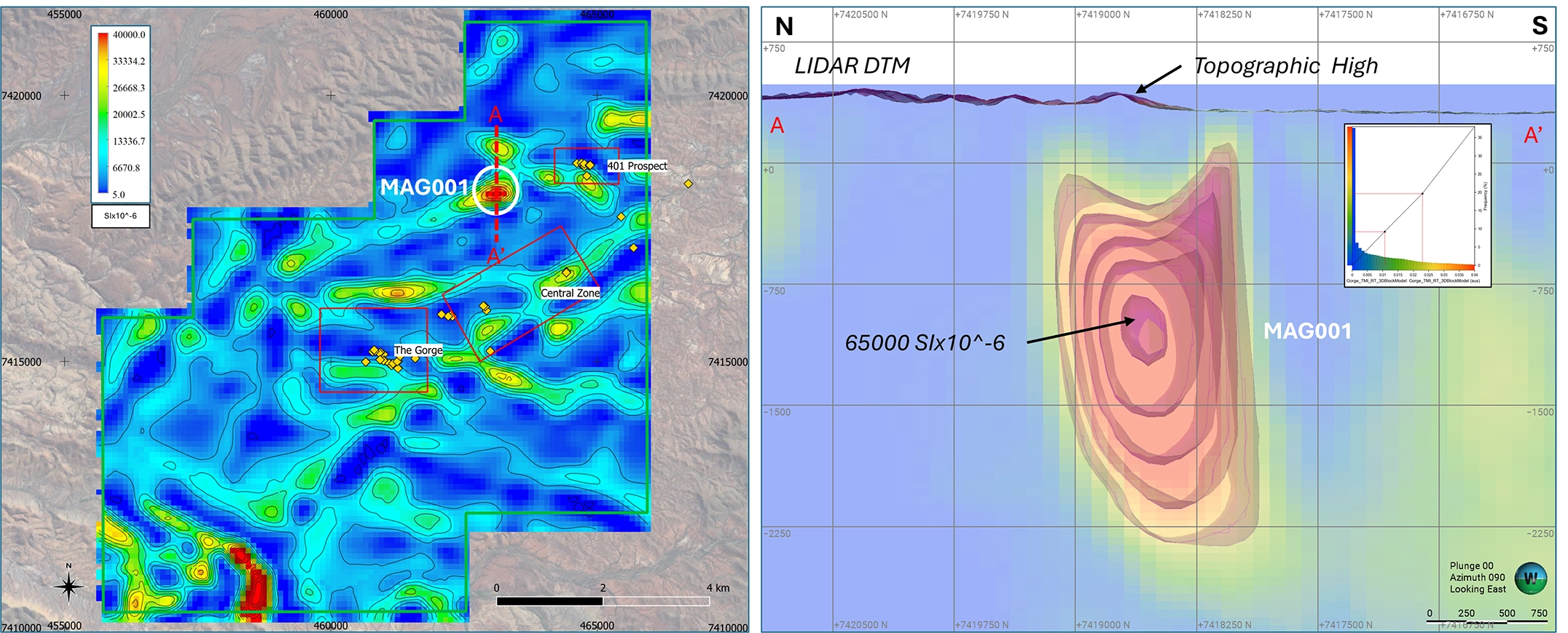
Figure 4 – Magnetic survey results with target areas, historical workings and tenement outline. (Left) 500m Depth Slice image. Plan View. (Right) 3D magnetic inversion isosurfaces & block model. Section View. Looking East VE1.
In addition, interpretation of the radiometric data has identified two significant uranium anomalies, RAD001 and RAD002, located proximal to the known gold trend. RAD001 is located approximately 300m from MAG001, providing a further area of interest for follow-up evaluation.
The combination of magnetic and radiometric signatures is considered encouraging and may be consistent with features observed in certain Iron-Oxide-Copper-Gold (IOCG) systems, including deposits such as Carapateena, Olympic Dam and Ernest Henry. Figure 5 below shows the radiometric survey results, including the RGB ternary image and uranium channel image across the Project area.
These magnetic, radiometric and topographic features will be integrated with the LiDAR, aerial photography, soil geochemistry and geological mapping datasets to assist GEO in ranking and refining priority targets for the proposed maiden drilling programme.
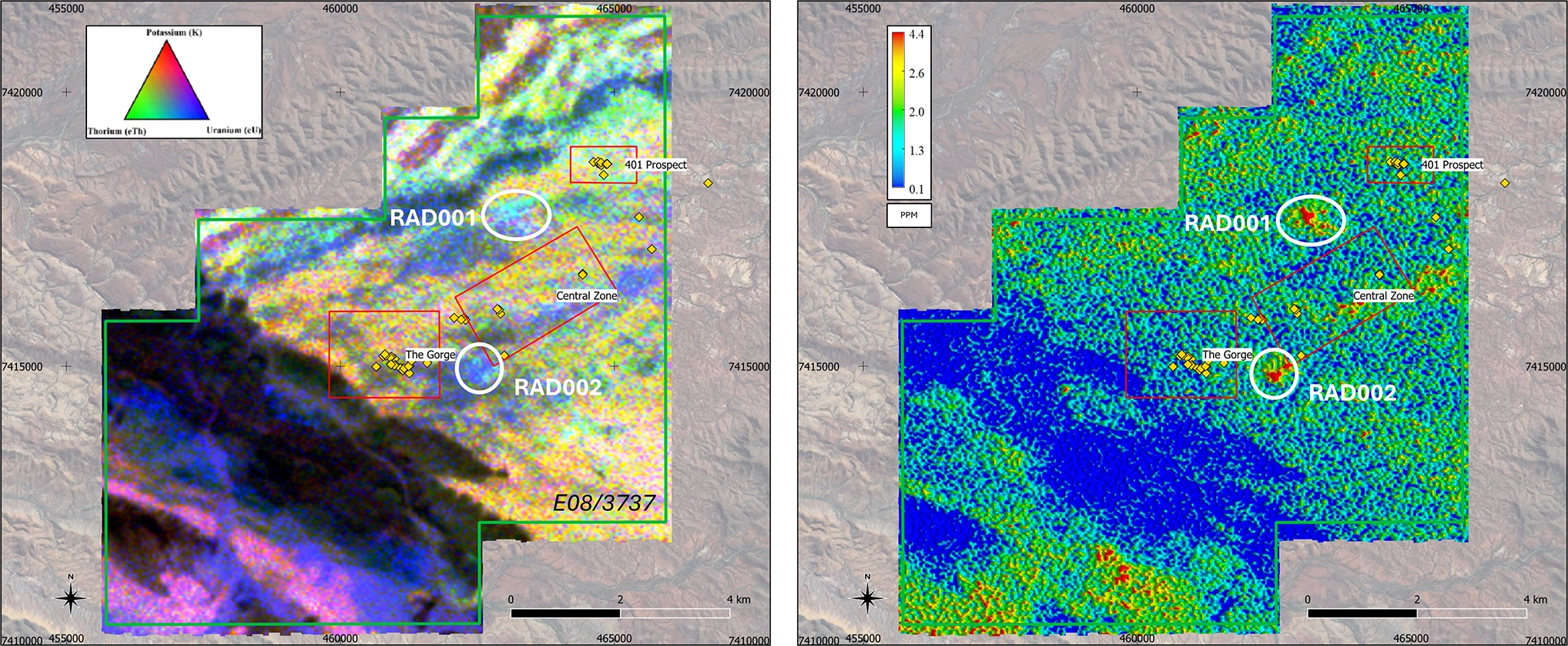
Figure 5 – Radiometric survey results with target areas, historical workings and tenement outline. (Left) RGB ternary image (Right) Uranium channel image. Plan View.
Field Reconnaissance Programme
Recent field reconnaissance undertaken between May and June 2026 has returned highly encouraging results across multiple target areas, further strengthening the exploration potential of the Gorge Project.
The work programme has confirmed significant field indicators across the Gorge Mine Prospect, 401 Prospect, and Central Zone Prospect, including visible gold in quartz vein material, historic hard-rock workings, copper-rich gossan mineralisation, and favourable structural geological features associated with gold systems.
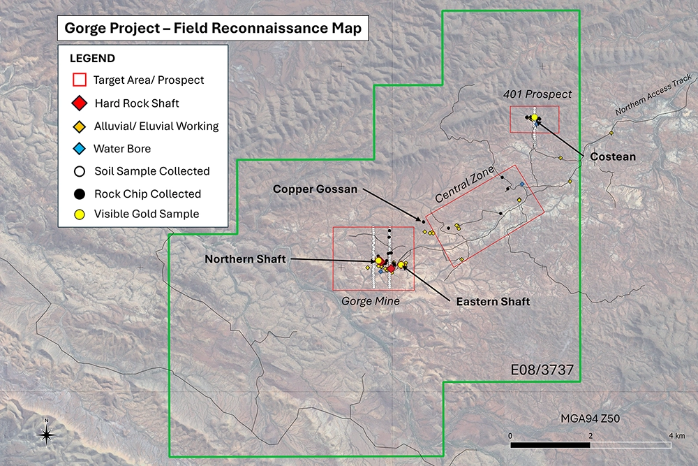
A detailed field programme was completed across the project during this period, comprising geological mapping, validation of historic exploration data, collection of rock chip and grab samples, and verification of historical workings and drill collar locations.
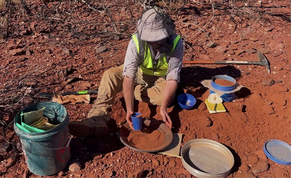
In addition, an orientation soil geochemistry survey was completed over key areas of known mineralisation to support the refinement of future exploration targeting.
The Gorge Project is characterised by excellent surface exposure and limited alluvial cover, providing highly favourable conditions for effective surface geochemical exploration.
Key Activities Included:
- Geological mapping and structural interpretation
- Validation of historic exploration results and workings
- 35 rock chip samples collected, together with grab sampling across selected target areas
- Confirmation of historic shafts, costeans, and drill locations
- Orientation soil geochemistry survey across key target areas
Soil Geochemistry Programme
The orientation soil geochemistry survey formed an important component of the May–June 2026 field programme and was designed to evaluate the effectiveness of soil geochemistry as an exploration tool across the Gorge Mine and 401 Prospect target areas.
Survey Highlights:
- 246 soil samples collected
- 80 sample sites across three profiles
- 50m sample spacing over known mineralised zones
- Samples submitted to Intertek Laboratories (Perth)
The orientation survey was designed to determine the most effective sampling and analytical methods for a larger soil geochemistry programme planned across approximately 5 km of prospective strike, encompassing historic workings and newly identified exploration targets.
The results will be integrated with geological mapping, rock chip sampling, historical exploration data, and airborne geophysical survey data to refine GEO’s exploration model, prioritise target areas, and support future drill planning.
Geological Observations
Field mapping identified evidence of a structurally controlled mineral system, including:
- Quartz veining & vein networks
- Faulting & folding structures
- Alteration zones associated with mineralisation
- Sulphide & iron-oxide mineral signatures
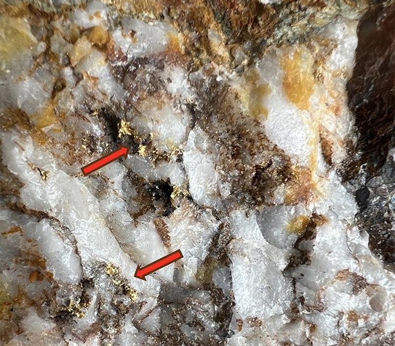
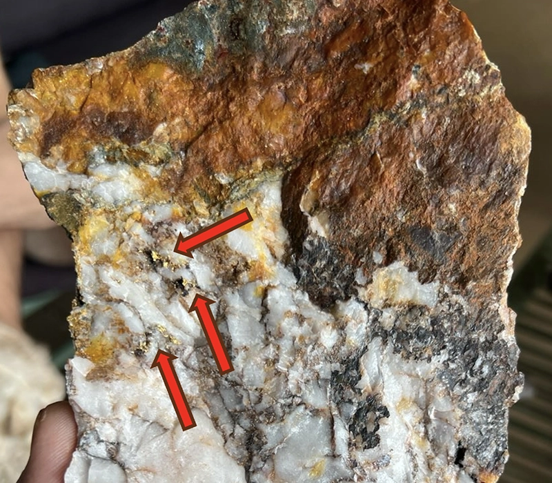
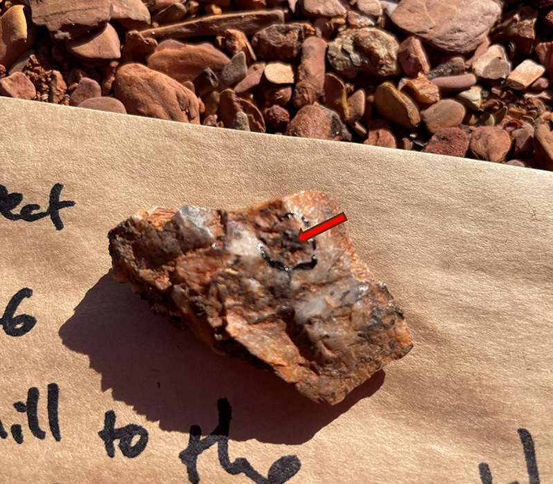
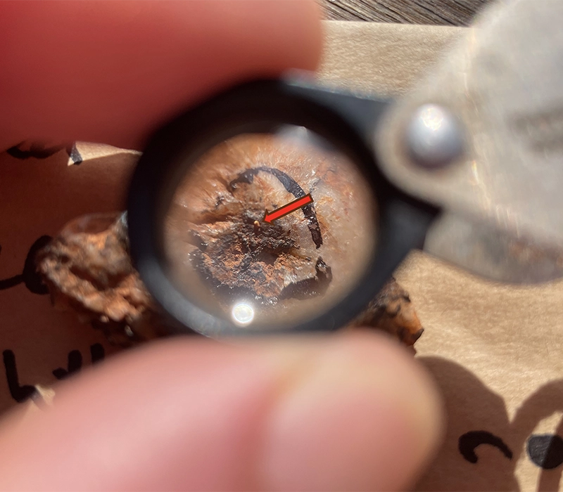
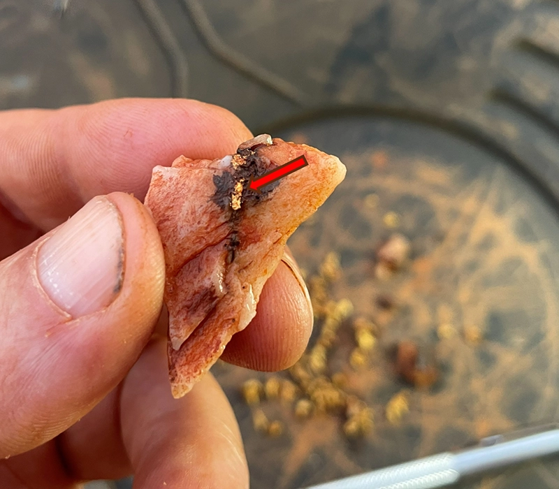
Importantly, visible gold was observed in quartz vein samples from all three prospect areas, including material associated with historic workings and mullock heaps adjacent to vertical shafts.
Samples of visible-gold-bearing material were provided by independent prospectors. These are considered encouraging and warrant controlled follow-up sampling and laboratory analysis.
Structural data collected during the programme will be integrated with recently acquired airborne geophysical datasets to refine exploration targeting and identify priority drill targets.
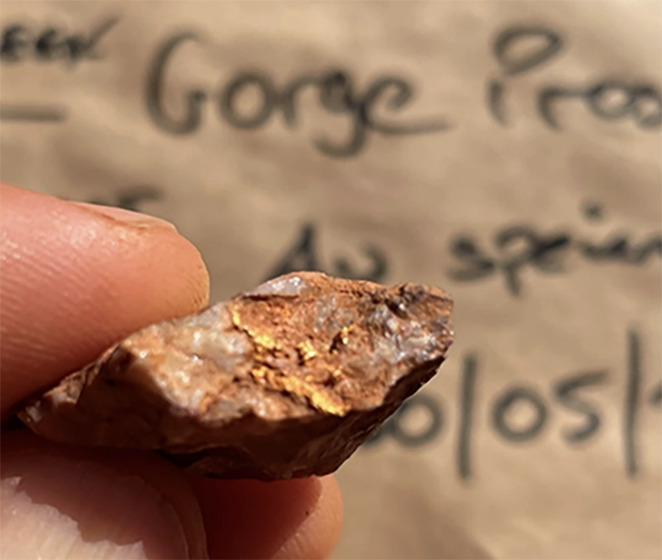
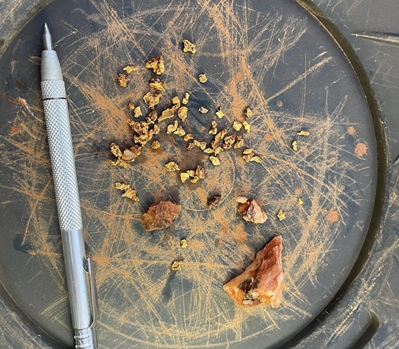
Visible gold in a quartz vein sample understood to have been sourced from mullock heaps associated with the eastern shaft at the Gorge Mine. Coarse free gold is observed along fractures and veinlets within the quartz vein samples.
Gorge Mine Prospect
The Gorge Mine Prospect is the highest priority target area within the Gorge Project and has returned some of the most compelling indicators of high-grade gold mineralisation. Historical records combined with recent field reconnaissance undertaken highlight significant potential for further exploration.
Historic records indicate:
- Reported bedrock mineralisation extending over 1km of strike
- Reported grades of up to 14 oz/t gold (approximately 450 g/t Au)
- Past production of gold, silver & lead from quartz vein material
- A 1.8m wide quartz vein containing sulphides including galena & cerussite
Recent reconnaissance confirmed:
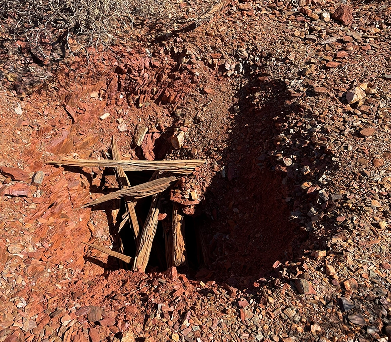
- Five open vertical shafts identified across parts of the prospect
- Shafts approximately 2m x 2m, open to estimated depths of 20–30m
- No evidence of modern exploration or drill testing recorded at the target area
- Multiple quartz vein orientations indicating structural complexity
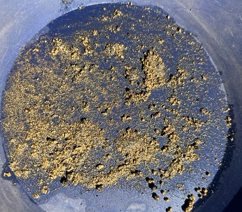
- Visible gold observed in quartz vein material from mullock heaps adjacent to the historic shafts
- Rock chip and grab samples collected from around historic workings
Visible gold was observed in quartz vein samples sourced from historic mullock heaps adjacent to vertical shafts. While these samples were not collected under GEO’s standard procedures and require controlled laboratory verification, they provide strong encouragement regarding the prospectivity of the Gorge Mine area. Historic records combined with field observations confirm the presence of significant historic hard-rock mining activity, sulphide-bearing quartz veining, and extensive alteration zones.
The Gorge Mine Prospect will be prioritised for controlled sampling of historic workings and mullock heaps. Results will be integrated with geological and geophysical datasets to refine structural interpretation and define drill targets.
401 Prospect
The 401 Prospect is one of the principal target areas within the Gorge Project and has demonstrated strong evidence of high-grade gold mineralisation through both historic exploration and GEO Exploration Limited’s recent field reconnaissance. The prospect hosts extensive quartz veining, favourable alteration, and historical drilling results that support its potential as a priority exploration target.
During the field programme, GEO’s geological team confirmed the locations of historical diamond and RAB drill holes. This validation enables historic exploration results to be more accurately reviewed and incorporated into the Company’s geological model.
Key Highlights:
- Historic RAB drill results include up to 35 g/t Au in RAB drilling
- Historic records refer to extracted ore reportedly returning 160 oz/t Au, equivalent to more than 5,000 g/t Au.
- Quartz veins up to 5 metres thickness identified during geological mapping
- Pyrite alteration observed within the surrounding wall rock
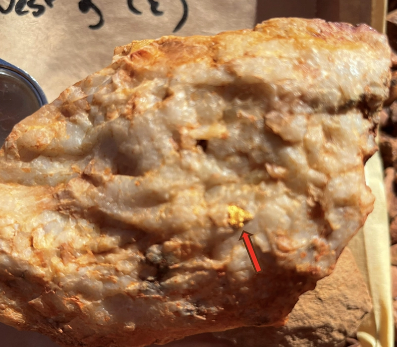
- Visible gold observed in quartz vein samples from historic costean areas
Geological mapping at the 401 Prospect identified extensive quartz veining and associated alteration. The presence of pyrite within the surrounding wall rock further supports the existence of a hydrothermal mineralising system and provides important vectors for future exploration targeting.
Visible gold observed in quartz vein material, while requiring controlled laboratory verification, is considered highly encouraging and is consistent with the presence of a mineralised quartz vein system associated with historic workings.
The validation of historic drill hole locations has enabled legacy exploration data to be accurately incorporated into GEO Exploration Limited’s geological model. This significantly improves confidence in the geological framework and supports more robust targeting of future exploration work.
The results from field mapping, sampling, and historical data validation will be integrated with geochemical and geophysical datasets to refine exploration targets. Follow-up sampling and future drill testing are planned to assess the continuity, scale, and grade of mineralisation at the 401 Prospect.
Central Zone Prospect
The Central Zone Prospect represents an important exploration target within the Gorge Project, demonstrating potential for both precious and base metal mineralisation. Recent field reconnaissance has identified geological features that complement the project’s primary gold focus while highlighting the broader multi-commodity potential of the area.
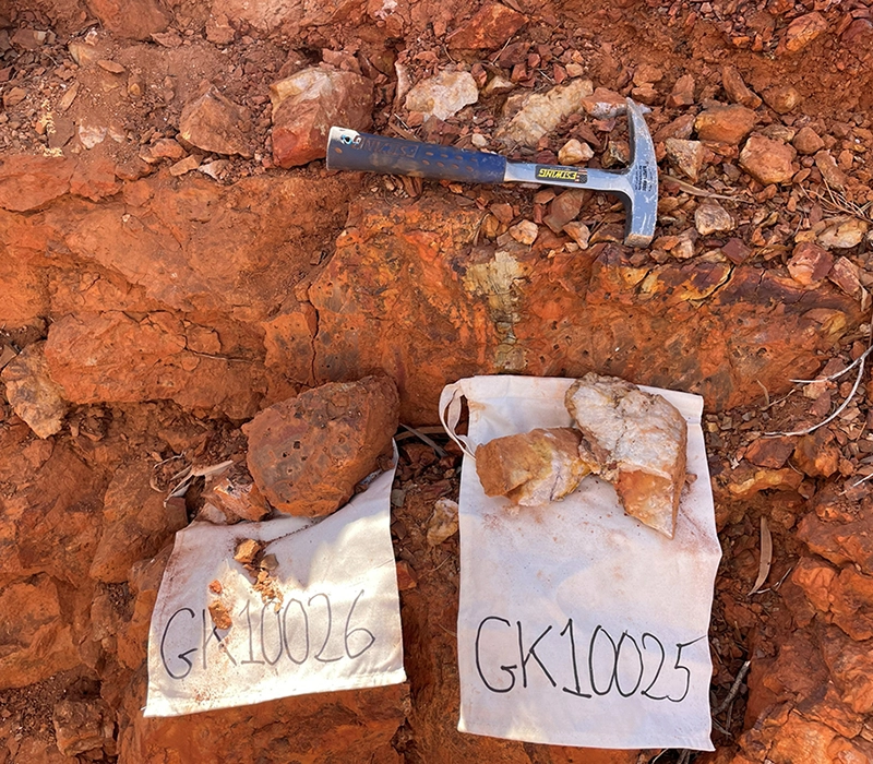
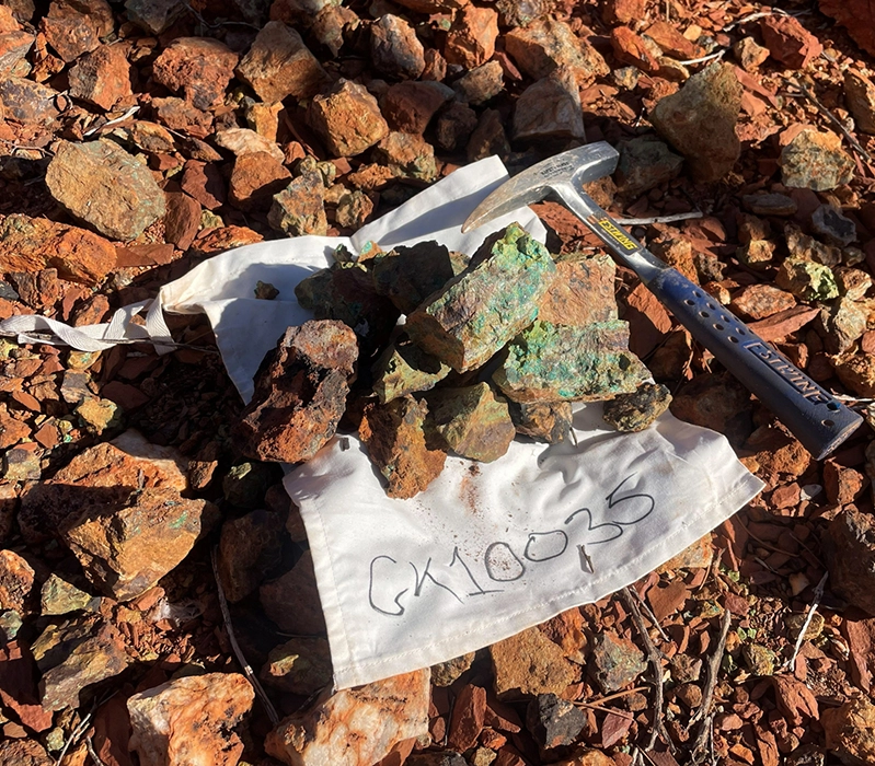
Geological mapping undertaken during the field programme identified a copper-rich gossan that had been historically worked. The gossan occurs at the contact between metasiltstone and metasandstone units, a favourable geological setting for mineralisation.
Key Features:
- Copper-rich gossan identified at surface
- Malachite & Azurite mineralisation observed
- Located at a lithological contact between Metasiltstone & Metasandstone
- Multiple zones of Sericite Alteration & Quartz Veining identified
- Historic workings confirm previous exploration activity
These observations complement the Project’s primary gold focus and support GEO’s view that the Gorge Project has broader multi-commodity potential.
Logistics & Infrastructure
As part of the field programme, logistical reconnaissance was also undertaken to assess site access and infrastructure requirements for future exploration activities.
Key Infrastructure:
- Accessible northern track network (mapped and assessed for upgrades)
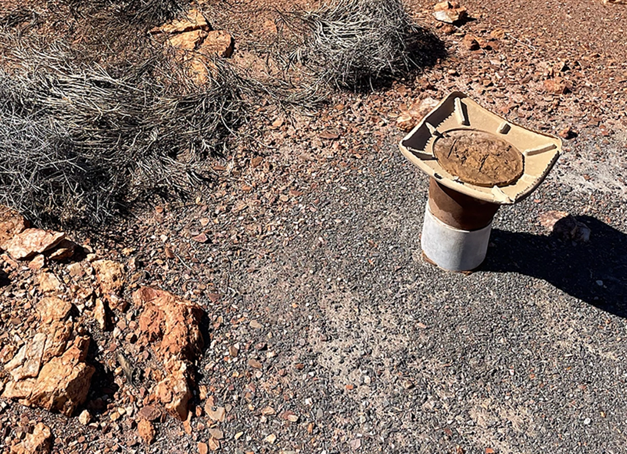
- 3 water bores identified across the Gorge Mine, 401 Prospect & Central Zone Prospect
- Fresh water encountered at all 3 bore locations within approx 20m of surface
The assessment confirmed several important logistical advantages that will support the efficient advancement of the Gorge Project, as exploration progresses towards drilling.
Current Status
A litho-structural interpretation of the recently acquired airborne geophysical survey data is currently underway. This work will support the selection of priority areas for follow-up exploration and drill targeting, as well as improve understanding of structural controls on mineralisation.
A soil geochemical programme is planned across approximately 5 km of strike length covering historical workings, as well as newly identified magnetic and radiometric targets. The programme will include around 1,150 soil samples collected on a 200m × 50m grid.
Additional geological mapping will be undertaken, supported by approximately 70 rock chip samples. Field staffing and required supplies have been secured in preparation for commencement.
Following completion of these activities, an integrated geoscientific interpretation will be completed to refine drill targets. Government permitting, heritage surveys, and access track preparation will then be finalised ahead of drill testing of the highest-priority targets.